I think this might be the most mileage I’ve walked in a week. What a varied week, passing through so many towns with tales to tell. This was the week I travelled through the ancient Cinque Ports (Hastings, New Romney, Hythe, Dover and Sandwich), established in 1155 by Royal Charter to maintain ships for the King in return for trade privileges.
The De La Warr Pavilion, Bexhill-on-SeaMy overriding feeling was that I walked too far, too fast and didn’t do it justice. There was always more to see and experience than I could fit in. Why did I cover so much ground? Mainly I think it was because I was struggling to find campsites (or other accommodation) that I felt was reasonably priced. I was finding the SE less friendly, very expensive and, of course, I was also suffering from the ground rush that comes with nearing the finish line.
Fishermen’s Huts, HastingsI found myself probably more frustrated this week than I had been for a long time, and yet there were still so many highlights.
Seven Sisters Country ParkThis week’s natural world highlights included a naked rambler (Seven Sisters), a grass snake (White Cliffs Country Park), a kingfisher (Royal Military Canal), and the stunning beauty of the Seven Sisters, Cuckmere Haven and the White Cliffs of Dover.
a grass snakeThe Sussex and Kent coastline that I walked this week is the closest to mainland Europe and was very heavily fortified in the 1800s. Some of the 74 Martello Towers that were built along this coastline still remain, as well as forts, redoubts and the Royal Military Canal. Napoleon really had us worried!
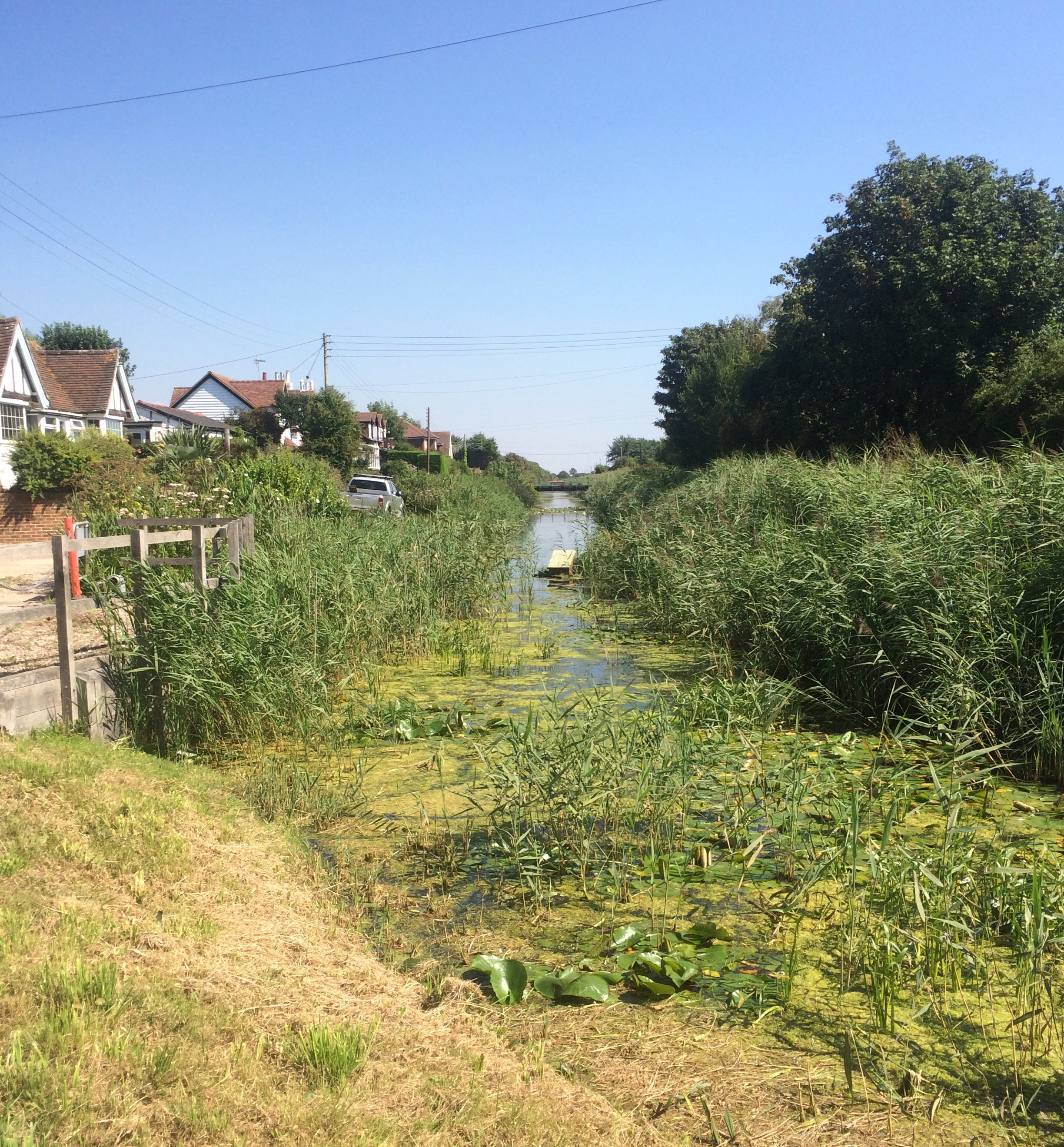
another Martello Tower, EastbourneI spent much of the week following long distance footpaths, mainly the Saxon Shore Way but also the Royal Military Canal Path, the North Downs Way and the Thanet Coastal Path. I began the week with white cliffs and ended it the same way, taking in the flat coastline in between.
Due to the windy weather I had a second night in a guest house. The cheapest one I could find was back in Folkestone so I was back and forth on the train to and from Deal. I had a nice night’s sleep in a clean room and a lovely homemade fish cake for breakfast so all was well.
DealI arrived back in Deal before 9am and set off along the sea front. I was still following the Saxon Shore Way, all at sea level, as I walked alongside the Royal Cinque Ports Golf Links as far as the Sandwich Flats. Not far after the rather exclusive-looking Sandwich Bay Estate I turned inland and headed for the town of Sandwich, where I could cross the River Stour.
SandwichSandwich seemed rather quaint with its old town, narrow streets and higgledy, piggledy buildings. I decided to stop for a coffee as it was already rather hot and a break inside a cool building was welcome. I didn’t see much of the town but I did spot the Fisher Gate, the only remaining Mediaeval town gate that was built in 1385 as part of King Richard III’s town defences.
The Fisher Gate, SandwichI left Sandwich and had a rather boring walk alongside an industrial estate and the A256 before I found myself in Pegwell Bay Country Park and heading onto the Isle of Thanet. The River Stour flows out into Pegwell Bay, but is connected to the River Wantsum and The North coast of Kent via a series of marshes and levels. This low lying land was once under the sea and I would have had to get a boat to the Isle of Thanet. By the 16th Century the Wantsum Channel had silted up and so it was drained and turned into farmland.
looking across Pegwell Bay to the rising chalk cliffs at RamsgateEbbsfleet is a small settlement overlooking Pegwell Bay and its claim to fame is that this is where the Saxon Warriors Hengest and Horsa are acknowledged to have landed in AD449. According to a commemorative stone, unveiled in 1948 (in time for the 1500-year anniversary) by Prince George of Denmark, this marked the “beginning of English history”, which I thought was rather amusing. The two warriors were followed in AD597 by St Augustine, a monk sent from Rome to set up a mission in Canterbury and spread Christianity to Southern England.
The Viking ship and the stone commemorating “the beginning of English history”The Thanet coastal path is named the Viking Coastal Trail and begins at a replica of the Viking ship ‘Hugin’ that was sailed from Denmark to Britain by Hengist and Horsa.
Pegwell Bay and the Sandwich FlatsIt seemed that Pegwell Bay’s more recent history was rather less distinguished as in the 19th Century it was where shrimp paste was made.
Thanet’s chalk cliffs rising up from Pegwell BayThe Isle of Thanet is known for its 3 seaside resort towns of Ramsgate, Broadstairs and Margate. All different and yet the same. The chalk cliffs rose up again around the Isle, punctuated by yellow sandy beaches.
East Cliff, BroadstairsFirst up was the port of Ramsgate. Approaching West Cliff the town seemed incredibly run down as most of the buildings next to the coast appeared dilapidated. It was quite a sad and depressing sight, but one which improved considerably as I rounded the cliff and overlooked the marina and the main part of town. This was more like it.
once a grand terrace, now dilapidated……this one’s in better nick!Van Gogh worked in Ramsgate for a year in 1876 and the town is proud of its association with the famous artist. I imagine the town was a lot more vibrant back then and the lovely green spaces on the cliff tops would probably have been buzzing with more people than there were today, enjoying the sea air, a band playing in the shade of the ornate bandstand and possibly strolling around the boating lake. Ramsgate had the feel of a once-genteel place that has fallen on harder times.
Ramsgate town and MarinaI passed the entrance to the WW2 tunnels; miles of deep shelter tunnels built at the start of WW2 to protect the citizens from air raids. It would have been nice to have stopped but I was on a mission to get to Margate so walked on, past the costumed volunteers.
The entrance to 2.5 miles of WW2 shelter tunnelsRamsgate merged into Broadstairs and I kept alternating between walking the cliff top (on the edge of suburbia) and the concrete walkway built at the base of the vertical, chalky cliffs. This was the blandest, smelliest and dullest walkway, which was such a shame.
My overriding memory of Thanet: a concrete walkway at sea level……the section approaching Margate – interminably dull!Perhaps it was just bad timing on my behalf but the weaving coastline and changing tides had trappes tonnes of seaweed that exuded a strong rancid smell akin to that of rotten eggs. There were very few people down at this level and that might also be due to the constant dead ends. Every so often the walkway would just stop and I’d have to retrace my steps to the nearest exit point.
The concrete walkway at BroadstairsFortunately there were lots of nice punctuations in the form of the 7 bays of Broadstairs (which are actually the 7 bays around the whole of the Isle of Thanet). Beautiful golden sandy beaches nestled between white cliffs; proper old-fashioned bucket-and-spade beaches.
Broadstairs’ town beachBotany Bay, the most northerly (and beautiful) of the 7 bays of BroadstairsWhere Ramsgate had been the scruffy tramp, Broadstairs was the civilised old lady. There was even a silver band playing to a silver-haired audience sat around the bandstand.
Broadstairs’ bandstandThe path took me past Bleak House, which fooled me because I knew that was a Dickens’ novel but I didn’t know it was the name of Dickens’ holiday residence. It turns out that Fort House was renamed Bleak House years later. A large and beautiful building overlooking the sea, it did not look bleak to me.
Bleak House, a summer holiday destination for Charles DickensI continued walking North along the top of the chalky cliffs, past the 18th Century Kingsgate Castle and on to Foreness Point. This was where I finally turned my back on France and began heading West, towards London.
Kingsgate Castle, above Kingsgate BayForeness Point was not large or a significant landmark, merely the site of a wastewater pumping station at the end of a grassed area.
Foreness Point, complete with wastewater pumping stationNext stop Margate: the quirky, loud one of the 3 sisterly towns.
Margate Lido – no longer in useI walked past the tidal pool at Walpole (somewhere I returned to a few weeks later to go for a swim). It was very large in area and quite at-one with the sea.
Walpole tidal poolApproaching Margate I noticed what looked like public conveniences by the harbour. As I got closer I could see the building was much too large and there was a cafe inside; this was the Turner Contemporary. Fortunately it looked better from the beach side. (This was another place I returned to visit later and really enjoyed.)
Margate Bay and the Turner Contemporary (not a public convenience!)It was late afternoon and I was tired. Because of the forecasted windy weather I had booked a night at the youth hostel in Canterbury so I headed rather quickly around the lively seafront and straight to the train station.
Margate beach and seafrontArriving in Canterbury I still had to walk right through the heart city; little did I know what a treat this would be. Yet again, without even meaning to, I had ended up seeing somewhere really beautiful that was not on my intended path. How lucky I am! heading into the walled city of CanterburyCanterbury
It was incredibly windy during the night, rattling the windows. I was glad I hadn’t camped. I feasted on biscuits and left early.
looking down on Folkestone HarbourI followed in the footsteps of thousands of soldiers and walked down the Road of Remembrance, the railings decorated with knitted poppies.
a poignant memorialThe tide was out at Folkestone Harbour and Sunny Sands Beach looked pristine as I gazed across it at the Coronation Parade at the base of the tall cliffs.
Folkestone Harbour at low tide, an enormous hotel in the backgroundThe Folkestone Mermaid looking out to sea from Sunny Sands Beach (sculpted in 2011 to rival Copenhagen’s Mermaid and inspired by HG Wells’ novel ‘The Sea Lady’, as he was a resident of Folkestone)The Parade was undergoing refurbishment and so was inaccessible. I had to back track and climb up lots of steps to reach the top of the cliff. The views back across Folkestone were excellent, and really showed how it commands a low-lying promontary protruding from the base of the North Downs.
the huge cliffs leading away from Folkestone and towering over East Wear Baylooking back down on Folkestone, the edge of East Wear and Warren Country Park and Martello Tower number 3, an old lookout stationBoy was it windy! The forecast had predicted 50mph winds and I was glad they were onshore because I was struggling to stand upright at times. Aside from the battle with the wind, it was a nice sunny day and a beautiful cliff walk, following the North Downs Way, to Dover.
the shear cliffs of The Warrenthe view along The Warren cliff top, looking down on the seaside train line between Dover and FolkestoneThe path took me straight past the Battle of Britain Memorial, sat high on the cliff top facing the English Channel. It was rather impressive and I stopped to wander around it.
The impressive Battle of Britain MemorialA bit further on I cut off the cliff top for a break from the relentless wind (I didn’t get one but it was easier to fight the wind when not on the cliff top). I spied the Varne Ridge Channel Swimming Holiday Park so went to take a look. The reception buildings were covered in plaques naming all the channel swimmers who have stayed at the park and their various records. It was quite an uplifting sight.
the entrance to the Varne Ridge Channel Swimming Holiday Park; so many plaques (this is just a few)The approach to Dover is via the Shakespeare Cliff, a huge chalk ridge. Peering over the edge I had a great view of Samphire Hoe.
peering down on Samphire Hoelooking at Shakespeare Cliff and the A20 heading into Doverwalking the precarious top edge of Shakespeare CliffI could see down onto Dover docks, in front of me was the Western Heights, and beyond that another hill with Dover Castle on top. I never knew just how hilly Dover is.
approaching DoverDover marinas, the Eastern docks and the castle on the hilla closer view of Dover CastleIt seemed like I went up and down and round and round the Western Heights in order to skirt around one of the largest and strongest forts in the country, the Drop Redoubt Fort. It was rather similar to the fort on Portland, built into the hillside.
Dover’s Drop Redoubt Fort on the Western HeightsI stopped at a cafe in Dover town as I needed a break. Once I’d re-gathered my strength I could take on the White Cliffs around South Foreland.
heading over the White Cliffs of Dover to South Forelandlooking back along the beautiful white cliffs to DoverThe National Trust owns a section of the White Cliffs so naturally there is a visitor centre and there were lots of people about. I could just about make out The coast of France through the haze.
Dover’s docks and breakwaterAll along the cliffs here there is plenty of military history: not only the castles, forts and Martello Towers, but also St Martin’s Gun Battery and Fan Bay Deep Shelter. The views from the gun battery were extensive. It was originally built in 1779, during the American War of Independence, and was added-to in the Napoleonic era and again in WW2.
relics of a military history embedded in the white cliffsUnfortunately I needed to have booked and paid to go in the deep shelter and have a tour of the interconnecting tunnels built to house the soldiers operating the gun battery.
South Foreland lighthouseSt Margaret’s at Cliffe seemed a rather smart settlement, nothing like its nickname of Hellfire Corner. It has created its own ‘Frontline Britain’ trail around the various historical military points. This small town was once the frontline of our defence, being officially the closest point to France and endowed with several gun batteries to shell enemy shipping.
the Dover Patrol Memorial at St Margaret’s at CliffeThe White Cliffs carried on to just before Kingsdown. Then they gave way to a long shingle shoreline protected by King Henry VIII’s Castles in the Downs. I walked past ones at Walmer, Deal and Sandown.
kingsdown and Deal, at the end of the chalk cliffsDeal Castle artillery fortI arrived in Deal with almost an hour to wait for the next train back to Folkestone.
Deal’s Timeball Tower, a Victorian maritime GMT signalI noticed a few craft beer places so I thought I’d check one out. I sat in the Taphouse Beer Cafe and sampled a few of the craft beers on offer (along with a pint of water). Not a bad way to end a very windy walk.
I set off along the sea front to Dymchurch and then on to Hythe. It was another grey day and the sea front seemed to go on forever just with changes to the type of promenade; concrete or Tarmac, raised or beach level, wide or thin.
grass promenade at Littlestone-on-SeaTarmac promenade on the way to St Mary’sI passed a lot of Martello Towers today, all looking slightly different depending upon their current usage or decoration.
one Martello Tower… …and another one (in disguise!)I passed along the fronts of St Mary’s Bay and Dymchurch, neither places looked particularly appealing.
another promenade, another Martello Tower, it must be Dymchurch!Halfway between Dymchurch and Hythe is the Dymchurch Redoubt, which was originally a depot built in the early 1800s to service the 21 Martello Towers in the short stretch between Rye and Hythe.
Dymchurch Redoubt, on Hythe RangesIt was a very grey day and heavy rain and winds were forecast, hence I had started early. I caught a bus for 2 miles along the main road from Dymchurch Redoubt to Hythe as the footpath was pushed off the sea front by Hythe Ranges and followed the main road.
the Royal Military Canal in HytheIn Hythe I found the Royal Military Canal again, as it cut out the the sea. The town centre was quite nice, with lots of independent shops, and I stopped at a lovely French Patisserie for coffee and a fancy cake as it had just started to rain.
always a sucker for great coffee and cakeHythe labels itself as “the jewel of SE Kent, where the countryside meets the sea”.
Hythe’s fisherman’s beach (more Martello Towers in the background)Like Hastings, Hythe also had a fisherman’s beach. It had stopped raining when I set off along the promenade to Folkestone, but it was very cloudy and only a matter of time before more rain fell. Fortunately, by the time it did, I would be ensconced in my hotel room for an evening of relative comfort watching the Olympics on television.
walking from Hythe to FolkestoneFolkestone has been a popular seaside resort since the 1800s (presumably after everyone stopped worrying about Napoleon invading). It has the requisite beach huts and promenade but sadly no pier. Its pier was opened in 1888 and demolished in 1954. In the meantime it was the host for Britain’s first ever recorded beauty contest, in 1907, that was one by Netty Bainbridge.
beach huts on the promenade, including one that was artwork in the style of a lighthouse)Folkestone is built on a cliff and so I found myself walking along the promenade at the base of the cliff. I didn’t need to walk up the cliff road as I could get the Leas Lift, a water balance cliff lift, up to the top.
the Leas LiftI walked past a few big hotels and through the main, soulless, shopping centre to get to the post office where I should collect my next set of maps. Yet again I was let down by the Post Office (for the 3rd out of 5 times) as their staff don’t even know what services they provide (despite previous phone calls and assurances). It was incredibly frustrating and I struggled to retain composure. The smallest things can seem soul-destroying on this sort of trip, and an extra 2 mile walk to be so frustrated was not a good end to my day. Fortunately there was a Waterstones in the town centre so I had to walk there and buy some more maps.
Welcome to FolkestoneI arrived at my hotel feeling miserable and lonely, and definitely not in the mood to be messed around with a sub-standard room (my wifi didn’t work so I had to move rooms after I had carefully strewn all of my wet kit and tent all over the place). It was just not my best afternoon. Roll on tomorrow!a folly tower built on the edge of Littlestone-on-Sea
I packed up early and headed off to catch the bus back to Rye, arriving before 9 am. This gave me chance to wander once more through the town in the quiet of the early morning and to stop for a big breakfast in a cafe.
the view from Rye down to the River RotherI admired the view from Ypres Castle atop the hill and walked through the last remaining landgate built in 1329 from a grant by King Edward III to fortify the town. Then I dropped down to the River Rother, crossed the bridge and headed for Camber.
crossing the River RotherCamber Sands was the first sandy beach I had seen since Littlehampton; most of the South East coastline being shingle. The sandy beach was lovely (although a couple of weeks later I found out how lethal the currents can be when sadly a few people lost their lives swimming here).
holidaymakers at Camber SandsI walked past some lovely houses built at the back of the beach, one of which I had spent a night in (thanks Nicki) a couple of years ago, and been swimming in the sea 2 days before Christmas. This time I didn’t stop for a dip.
houses at the back of the beach (4×4 vehicles required)Rather than walk through the deep sand I climbed onto the sea wall to walk to Jury’s Gap, where I was forced inland to Lydd as there was no way across Lydd Ranges. The sea wall was part of a new coastal defence scheme and only opened in March 2016. It is designed to protect 1,400 homes and businesses across the low-lying marshland, sandwiched between the sea and the Military Canal.
walking the sea wall to Jury’s GapIt was going to be a boring, hot walk alongside the road to Lydd so I cut out about 3 miles by catching a bus. It saved me about an hour and carried across the county border into Kent.
expansive views across Walland and Romney MarshesFrom Lydd I followed the huge overhead power cables that tracked over the ranges and led me across Denge Marsh and Denge Beach to Dungeness. What an eerie place!
Dungeness Power Station viewed from LyddI could hear gunfire on the Lydd Ranges and stopped to ask for guidance from a guard to check that I could reach Dungeness Power station following the road/track I was on. I passed a strange, dilapidated farm in the middle of the ranges and in the shadow of the power station pylons. As I walked past it there was a flock over a hundred gulls (I tried to count them) swirling high overhead and I thought I might have walked onto the set for a horror film. Very odd.
following the power lines across the barren shingle to Dungeness Power StationThe landscape was so desolate and wind-blown, and of course the main ingredient on the ground was shingle.
the long shingle beach following West Road to DungenessI knew I was walking towards a power station because the weather had turned grey and overcast. This surreal landscape was enhanced by a grey sky, a grey landscape and a grey sea. I had ventured into another world.
arriving at Dungeness…it’s another world!I had to endure some walking across the shingle to reach the power station and then the settlement of Dungeness. Weirdly, on the beach in the middle of nowhere, I passed several groups of people. There were the usual fishermen casting their lines from the beach and then there were several Asian families enjoying a day out. No one even looked at me so there was no opportunity to engage in conversation. Perhaps if they had I might have seen their red, alien eyes and been immediately extinguished (or maybe that just happens in the movies).
Dungeness Lighthouse and one big houseI arrived at Dungeness, a strung-out town built on the shingle at the point of land where the West Road meets the East Road (these are the names given to the stretches of sea, they are not land-based roads). It was a place with an other-worldly feel to it so I felt compelled to stop at the Britannia Inn for fish and chips.
Dungeness community: small houses spread about the shingle wastelandDungeness lighthouse dwarfed by the Power StationDungeness is a popular tourist destination and I had just missed a coach load of tourists. I could have paid to climb up the lighthouse; however, it didn’t seem worth it when everything around was grey and indistinguishable today.
wooden shacks – some old, some newMost of the Dungeness houses were wooden shacks, originally created from old railway carriages. (The one opposite the pub was apparently Queen Victoria’s personal carriage.)
houses that were once railway carriages……was this one Queen Victoria’s personal railway carriage?Some of the houses had been given “Grand Designs” makeovers and looked quite futuristic. It seemed like such a strange and fascinating place to me.
Grand Designs?I turned North and walked along the road to Littlestone-on-Sea, the seaward extension of New Romney. I walked along the road because the other option was to continue across the ever-widening shingle beach. I suppose I could have caught the miniature steam train that travels from Dungeness to Hythe along the small-gauge railway line behind the houses that line the road. Such an odd place.
beware of small trains!Behind the houses and the railway line was the Dungeness National Nature Reserve, one of the largest areas of vegetated shingle in Europe. This included old gravel pits, which were the habitat for bloodsucking medicinal leeches. I didn’t stop for a swim!
The New Romney Caravan Park was at the other end of the scale to the abominable place at Camber Sands. This one was run by an ex-Army man and he kept a small bit of grass for hikers, cyclists and the like who needed somewhere to pitch for the night. He charged me £7 and I was able to use the laundry and get a meal in the on-site bar. Perfect. this house was my favourite (it had a lovely garden and a poem inscribed on the side wall)
I decided to leave my tent where it was and walk ‘light’ for the day as I could get a bus back from Rye. I was intending to walk to Camber Sands, where there is the only campsite for the next 30 miles. However, it would have cost £53 for me to pitch my little tent for the night. Ridiculous. (It was another of those detestable parks with “computer says ‘no'” staff.)
Camping by the road at Camber Sands – it could have been me for £53 per night!I left early and walked through Hastings Country Park on the top of the cliff, part of the High Weald AONB.
Hastings Country ParkIt was sunny, hot and hazy under a bright blue sky. A beautiful day. The views from the cliff top were extensive, although I couldn’t see France.
looking down on Covehurst Bay and Fairlight CoveI was following the Saxon Shore Way, a 163-mile long path that follows part of the coastline from Hastings around to Gravesend. At least this path was relatively well-marked.
I passed through Fairlight Cove, a small town surrounded by lots of trees, and on to Cliff End. Here was the start of the Royal Military Canal. This amazing defensive structure (the 3rd longest in Britain after Hadrian’s Wall and Offa’s Dyke) was completed in 1809, having been begun 5 years earlier when the threat of a Napoleonic invasion was high on the agenda, just before he was defeated. The canal was still finished, although in most places it is not as wide or deep as it was intended. It is 28 miles long and cuts off the vast, low-lying marshland that sits behind the pointed corner of land that is Dungeness. So Napoleon’s Army might have landed on the flat beaches but hopefully it would have come unstuck at the canal that bisects the land from Hastings to Folkestone.
the start of the Royal Military Canal at Cliff EndI walked inland, along the canal bank, as far as Rye, passing Winchelsea on the way. I had to walk inland to Rye in order to cross the River Rother. It was an open walk next to the water and I saw plenty of dragonflies, swans, ducks, a couple of buzzards and a kingfisher.
walking alongside the Royal Military Canal, near RyeWinchelsea (including the Strand Gate) on the hill rising above the Royal Military CanalAs well as the wildlife I could see all across the edge of the flat marshland that led to Rye Bay.
the flat marshland, grazed by sheep, between the Canal and Rye BayIn the middle of the flat land was Camber Castle; strange to build it in such a location I thought.
Camber CastleRye is a beautiful old, walled town, perched on a small hill overlooking the River Rother and the surrounding marshland. I wandered up and down the narrow cobbled streets admiring the architecture.
one of the steep cobbled streets inside Rye CitadelIt was very hot so I stopped for a break at the Mermaid Inn, in the heart of the Mediaeval citadel. Apparently some of the bedrooms have secret passages.
The Mermaid InnAfter cooling off I carried on wandering, stopping only to buy an amazing pork pie from Simon the Pieman’s shop to keep me going.
Rye’s sole remaining landgate of the 4 built from a grant given by King Edward III for fortifying the town in 1329I was going to catch the train back to Hastings but hopped on a bus instead. I was surprised to find it more expensive than the train.
looking at Rye perched on the small hill, viewed from Rye HarbourThe heat had sapped my energy and I needed another stop in a cool, dark pub in Hastings Old Town. I was back early afternoon so I had time to wander along the Stade Beach again and to visit the Fishermen’s Museum before I caught the East Hill Lift back up to my campsite.
East Hill lift viewed from Stade fishermen’s beachI spent the evening in the on-site bar again. It was bingo night and fairly soulless but I was too tired to walk into town.
Another beautiful blue sky day dawned and I set off along the edge of the never-ending shingle. I passed Martello Tower after Martello Tower; some derelict, some reinvented and some quite neatly disguised within a newer building.
another Martello Tower, Pevensey BayThere was no specific coast path so sometimes I had to either trek along the shingle or head inland through housing estates in order to weave a route that followed the shoreline. It was not as easygoing as it looked on the map.
Pevensey Bay shingle; looking back to the South Downs at Beachy HeadPevensey Bay was the first settlement I passed; the traditional site of the landing of the Normans in 1066. My map told me this but there were no indicators on the ground.
approaching BexhillI followed the train line past Norman’s Bay and on to Bexhill, “the birthplace of British motor racing”. In 1902 Earl De La Warr created the centre for British and International motor racing by holding the first race meeting in Bexhill. I walked up Galley Hill, a very small incline at the end of a long straight road, that must have provided quite a challenge to early motor cars.
Galley Hill; only small but probably a mountain for first generation motor carsthe Bexhill promenade from Galley Hill; looking back to Beachy HeadThere were plenty of references to its motor racing history in Bexhill, including a museum. However, those were the glory days of the past, when 30,000 spectators lined a 1km route, and now the town seemed more like ‘Suburbia-by-the-Sea’ to me.
a sculpture of Serpollet’s “Easter Egg” steam racing car – one time holder of the world land speed recordin suburbia – the closest walkway to the shingle beachI followed the new footpath across Glyne Gap and on to St Leonards-on-Sea, which seems to have been swallowed up by Hastings.
The Glyne Gap, between Bexhill and Hastingslooking ahead to HastingsApproaching St Leonards it looked quite run down. There were a few hotels but they didn’t look much. The sea front was built on a wide undercliff, so there was an even taller cliff behind the tall buildings. It was a shame it looked so downtrodden up close.
tired-looking sea front buildings built under the cliffSt Leonard’s sea front and pierHastings looked equally deprived upon approach from the West. At the eastern end, sandwiched between West Hill and East Hill, was Old Town. This area looked vibrant and colourful, and full of history.
Hastings Old Town, beneath East HillStade beach was littered with fishing boats and their related paraphernalia. Immediately behind the shingle were long, tall, black wooden huts that were once fishermen’s net-drying huts. Many have now been converted into shops, restaurants and a fisherman’s museum, which I had a look around.
fishermen’s net-drying hutsI discovered that Hasting’s Stade (the fishermen’s beach) is the largest beach with a moored fishing fleet in the UK.
the Stade’s fishing fleetThe Stade in front of East HillThe town itself seemed to squashed in between the 2 hills and had 2 cliff railways. I paid my fare to go up the East Hill Lift.
fishermen’s net-drying huts in front of East Hill liftAt the top of East Hill was Hastings Country Park, and my campsite destination. It was expensive at £22, but I had to get used to that in the South East.
looking down from East Hill lift to Stade BeachI was tired and so, after my chores, I headed to the on-site clubhouse for some dinner. I couldn’t face a long walk down (and back up) the hill into town. Hastings Old Town
I was late leaving Seaford as first I had to dry my tent and then I needed to stop for breakfast. The Seaford Sailing Club provided a passable breakfast and I was able to charge my phone.
looking back along Seaford beach towards the mouth of the River OuseIt was shaping up to be another glorious day as I walked along the promenade next to the steeply sloping shingle beach. I read that Seaford was particularly susceptible to storms so tonnes of shingle had been added to the beach to protect the town. The beach now sloped steeply and reached the height of the promenade.
Martello Tower 74On the edge of the town was Martello Tower 74, the last one to be built (1806) to counter the Napoleonic threat.
I was following the Vanguard Way, a long distance path from Croydon to Newhaven: “from the suburbs to the sea”. It climbed up Seaford Head and the views from here were outstanding.
looking back from Seaford Head (note the beach that has been reinforced with tonnes of added shingle)looking ahead at the Seven SistersSeaford Head is the start of the Cretaceous chalk cliffs that stretch around Beachy Head to Eastbourne. I had a great all-round view; back to Brighton, inland to the South Downs and ahead to the Seven Sisters. I also looked down over Cuckmere Haven, the flat plain containing the beautiful, meandering Cuckmere River.
Cuckmere Haven and the Seven SistersI had to walk inland to cross the Cuckmere River at Exceat Bridge. I stopped in the pub to shelter from the heat and enjoy a cold drink as I knew the next section would be tough because I’d walked it before. It is the walk to the finish of the South Downs Way.
the beautiful, meandering Cuckmere Riverlooking back down on Cuckmere HavenThe Seven Sisters are 7 peaks along the chalk cliffs to Birling Gap. They are separated by hanging valleys that were created after the Ice Age and left hanging when the sea cut back. They lie within the Seven Sisters Country Park and are as beautiful (and almost as brutal) as the walk over the cliffs to Durdle Door.
up and down the Seven Sisters……tough going this!I was in for a treat, not only was it very hot I found myself keeping pace with a naked rambler (I can’t claim he was the naked rambler). Oh joy, now I had to think about where I was pointing my camera and whether I looked like I was looking! (I wasn’t.) He was creating quite a stir amongst the tourists and it made me chuckle. As we were keeping pace (I kept stopping to take photos and he was slower on the downhills in his bare feet) I thought it would be rude not to engage in a brief chat. He seemed very nice. I didn’t really look at him though, which I thought afterwards was a shame that I felt too embarrassed to look him in the eye (in case I saw anything else); he was only naked after all. I think the foreigners out that day will think the English are very strange!
a ‘cheeky’ photo of the naked rambler!After all that excitement I arrived at Birling Gap and it was very busy on the beach at the base of the cliff. I carried on.
the popular beach at Birling GapI did notice the Beachy Head Chaplaincy Team crisis prevention vehicle. Sadly it looked like this area requires a 4th emergency service.
Eastbourne’s 4th Emergency Service?Up another hill to the Belle Tout lighthouse (now a holiday cottage) then down again and up again to Beachy Head. The cliff is high and a leap would land you at the bottom.
Beachy Head and its lighthouselooking down at the Beachy Head LighthouseThere were a few memorial crosses near the top.
memorials on Beachy HeadI could see Eastbourne and along the coast as far as Hastings. I walked off the South Downs Way and onto Eastbourne seafront. (Apparently Eastbourne was known as the Empress of Watering Places.)
the view of Eastbourne and beyondThe Eastbourne esplanade was, without question, the smartest I had walked along in the whole of Britain. It was flanked by palm trees and flowers, and even its shelters were freshly painted and had thatched rooves.
the greenest esplanade yet!a thatched-roof shelter on Eastbourne EsplanadeIt was a long way along the esplanade and it became apparent that I’d just missed the annual Airshow at the weekend. The clear up was underway and the ‘exclusive seating’ was being dismantled.
the RAF Ensign flying above Eastbourne EsplanadeEastbourne bandstand (no band but there was music being played from speakers and some people sat listening to it)I reached the pier and everything changed. There was a stark contrast between the Victorian grandeur of ‘West of the pier’ compared with the normalcy ‘East of the pier’. This was because in the late 1800s the Duke of Devonshire bankrolled building a resort “for gentlemen by gentlemen”, but only West of the pier. East of the pier was where the fishermen, tradesmen and domestic servants lived. West of the pier catered for the upper classes and there was even a published fashionable visitors list where one could announce one’s presence in the town. Amazingly, the seafront parades heading East and West from the pier did not even connect during this period.
Eastbourne Pier (complete with golden cupola)what a change East of Eastbourne Pier!I had to walk right through Eastbourne and around the Sovereign Harbour (which looked like a new-build marina full of apartments and restaurants as well as boats) before I reached my campsite.
walking the shingle past another Martello Tower, on the way to the campsiteThe wind had picked up and I requested a sheltered spot. I wasn’t given one. I erected my tent and then collapsed it again before going for a shower. I spied a small patch of ground behind a bush and asked to move. Much better, although quite a faff. By the time I finished my chores it was 8pm and I had to walk 15 minutes back to the marina to get some food. It had been a long, and very beautiful day.
a wonderful view from Beachy Head across the Seven Sisters to Seaford Head
A lot of distance covered this week, even though I slowed down at the end. It wasn’t my favourite week by any means and one that bust my weekly budget.
This week everything suddenly got more expensive. East of Portsmouth the going rate for a campsite more than doubled, despite the facilities offered certainly not being better than further West. Cafes are also more expensive, and so far most have been of a worse standard than I have been used to. Add to that the slightly boring aspects of walking long, flat promenades and that goes some way to explaining why it wasn’t my favourite.
worst walk this week was past the lorries at Portslade-by-SeaAll in all this week felt like a bit of a battle; a battle to find campsites that would squeeze me in, places that didn’t overcharge by more than 100% of what I felt their value was, no people to chat to.
apparently there was a marked path!In summary, I would not recommend the Hampshire and Surrey coastline for hiking for following reasons:
1. There are not many coastal footpaths and they are badly signposted. Be prepared to get lost, trudge along shingle and walk through housing estates.
2. Campsites are not hiker-friendly. You get charged full price and only if they have a spare pitch available; they will not entertain squeezing you in and people on the phone are generally rude.
3. It is expensive and not worth it. The campsites and cafes are no better, the beaches are shingle and the sea not as clear as further West.
4. It is crowded (which is probably why no one cares – they don’t need to).
I could not find any favourable comparison between the South East and the South West. The only difference is proximity to London.
The sun didn’t reach my tent as I was tucked into a big hedge so I had to dry it before I left.
the chalk cliff, starting behind Asda at the MarinaThe campsite wasn’t at the smartest end of town, tucked in the Sheepcote Valley. Luckily I passed a shop to get something to eat as I had gone without dinner last night.
Brighton Marina housing developmentBrighton Marina has been renovated into a shopping complex and a housing estate, as well as berthing boats.
the chalk cliff also extends under the seaThe chalk cliff began at the marina and there was a path along the Undercliff past all the deans: Roedean, Ovingdean, Rottingdean and Saltdean. I decided to forgo the view from the top of the cliff and walk down by the sea. It was a popular path and there were lots of joggers using it.
looking back along the undercliffThe Black Rock cliff preserves one of best and most accessible sedimentary records of ice age climate in North West Europe. It is hidden away at the back of Asda at the marina. I thought it was quite impressive and clearly showed sandy cliffs becoming chalk and a visible Flint line that was a beach 250,000 years ago. All this history stuck at the back of a modern superstore.
looking at the past, buried in the cliffAt Rottingdean I came up into the town that was once the seaside home of Rudyard Kipling. I walked up the high street to a pub and went for a second breakfast, coffee and the chance to charge my phone. It was also a nice break from the heat.
Rottingdean Terraces Stage – used for productionsI wanted a look at Saltdean’s lido; it wasn’t what I expected as it was undergoing renovation.
Saltdean Lido – closed for refurbishmentFrom here I stayed on the top of the cliffs and admired the view. The sea looked, and sounded, lovely.
the view back along the chalk cliff towards BrightonPeacehaven had a monument to signify where the Meridian Line passes through; 48 miles to London as the crow flies.
The Greenwich Meridian passes through this spot, on the cliff at PeacehavenApproaching the Newhaven Fort, the guardian of the entrance to the River Ouse and the ferry terminal, the views were excellent. I could see the huge, white cliff of Seaford Head across the mouth of the river.
the mouth of the River Ouse and Seaford Cliff in the distancethe pier at the end of the River OuseI had to go a mile inland, into the centre of Newhaven, to cross the River Ouse. As I approached the bridge I noticed a ceremony taking place. I went to take a look and stayed to watch the annual Ceremony of Remembrance commemorating the 1942 Dieppe Raid. Lots of wreaths were laid and the sound system failed so the audience had to sing the Canadian, French and British national anthems without help. The first 2 were a challenge. At the end of the ceremony the vicar came over and chatted to me and then ‘Lonney’ came and asked me about my walking poles. He was in his 90s and a veteran of the Dieppe Raid. What a privilege to chat to him.
the annual Dieppe Raid commemoration in NewhavenIt was well after 5pm when I finally arrived at the campsite, on the edge of Seaford. The land on the East of the mouth of the River Ouse was very low-lying and had the remains of dwellings. Originally the river flowed along here but a huge storm in the 18th Century burst through the shingle and straightened the river. Tidal lagoons were left behind but these have slowly been drying up and so the Tide Mills have long since closed.
the ruins of Tide Mills, behind the shingle beachI pitched my tent, showered, hand-washed my clothes and then walked into town to the nearest pub for some decidedly average food. By the time I walked back in the dark the night fishermen were out in force on the shingle beach.
an extra large cormorant at Newhaven (it’s not real!)


