I walked around most of the Isle of Wight Coastal Path. I figured I could miss out the bit between Cowes and Yarmouth as it is mostly inland anyway and this would mean I could get the ferry to Southampton. By doing this I missed out an inland walk from Lymington to Hythe, past the oil refinery.
a stunning “Jurassic Coast” along the South of the islandEight thousand years ago the Isle of Wight was part of the mainland and the Solent was just a river. That was before the Ice Age made it into an island. Having walked from The Needles to Foreland, I was struck by how this whole South Coast section of the IOW was really just a continuation of the Jurassic Coast.
Bembridge lifeboat stationFinally, I can’t believe I didn’t see any red squirrels all week. Gutted.
Despite an interrupted sleep I was up early. It had rained! Only for about half an hour at 5am. The skies were grey with no sign of sun.
looking at Cowes across the River MedinaI headed for the chainlink ferry across the River Medina to Cowes. Although only separated by a river, and sharing a name, East Cowes and Cowes are quite different. East Cowes is small and known for its shipbuilding. There are still big sheds facing onto the river. The most famous is the Columbine Shed, which belonged to the Saunders-Roe firm who built seaplanes (beginning in 1913) and then hovercraft. The world’s first hovercraft was built and launched from here in 1959. Since the Queen’s Jubilee in 1977 the Columbine Shed has been recognised by its Union Jack door.
The Columbine Shed in East CowesThe chainlink ferry has been running since 1859 and before that there was a rowing boat and a horse-winched barge. It cost me £1 for a return ticket, which saves a trip into Newport and out again. What a bargain.
the chainlink ferry crossing the River MedinaCowes is known as the home of world yachting and the birthplace of the America’s Cup. At 8am it was pretty quiet, which was understandable after last night’s party. Sailing types were appearing though and could be distinguished by their slightly dishevelled (but not too dishevelled) appearance, Musto clothing and enormous kit bags. I did not look the part. Never one to let that deter me I headed straight for the marina.
one of the Cowes Marinas during Cowes Week…so many yachts!Around the moored yachts sailors were scurrying around like little ants. I stood on a jetty and watched. From the variety of accents and the markings on the boats (e.g. a big silver fern) it was obvious that this was an international event.
even the RAF had a yacht racing at Cowes WeekI had company and we started chatting. This man was sailing on a very nice yacht (worth £80k) that his (very rich) friend owned. He filled me in on what happens at Cowes Week. It did sound like a lot of fun. In return I told him about my trip and he thought it sounded cool so we were even.
the race start…avoid the tanker!Next I wandered through the town. More sailors. Everywhere. All getting coffee. I bought a pain au chocolat from the bakery and carried on. I wanted to see the Royal Yacht Squadron (RYS): the home of yachting. I wondered if I might be able to blag my way in for a spot of breakfast, but that was never going to happen. One has to be a bonafide member of this place.
The Royal Yacht SquadronI discovered that the RYS runs Cowes Week. In front of the exclusive clubhouse was a flagpole (able to hoist 9 flags) and a row of cannons. Katy was prepping the cannons and then Paul arrived in ful rig (complete with hat). They were both employed by the RYS. I chatted to the two of them and learnt lots about how the racing works. Essentially, flags are hoisted to signify which class of boat is due to start, then the small cannons signify prep and the big cannon the start. However, while some are prepping, some are starting so it all gets complicated.
Peter outside the RYS, operating the flags and cannons to start (and finish) the racesThe first race started around 10am and by then there looked to be scores of different sized yachts milling about near the start line. To add another complication, there were also ferries, container ships, sea kayakers and moored yachts. This was chaos. Fun though.
prepare to fire…I wandered back through town and stopped for a coffee and bacon sandwich. I had had enough of the “sailing set” so caught the chainlink ferry back to East Cowes and returned to the campsite to pack up. Within an hour I was on the ferry to Southampton.
…fire!I had a great view of all the races as we crossed the Solent and entered Southampton Water. The wind had picked up and some of the boats looked like they were flying.
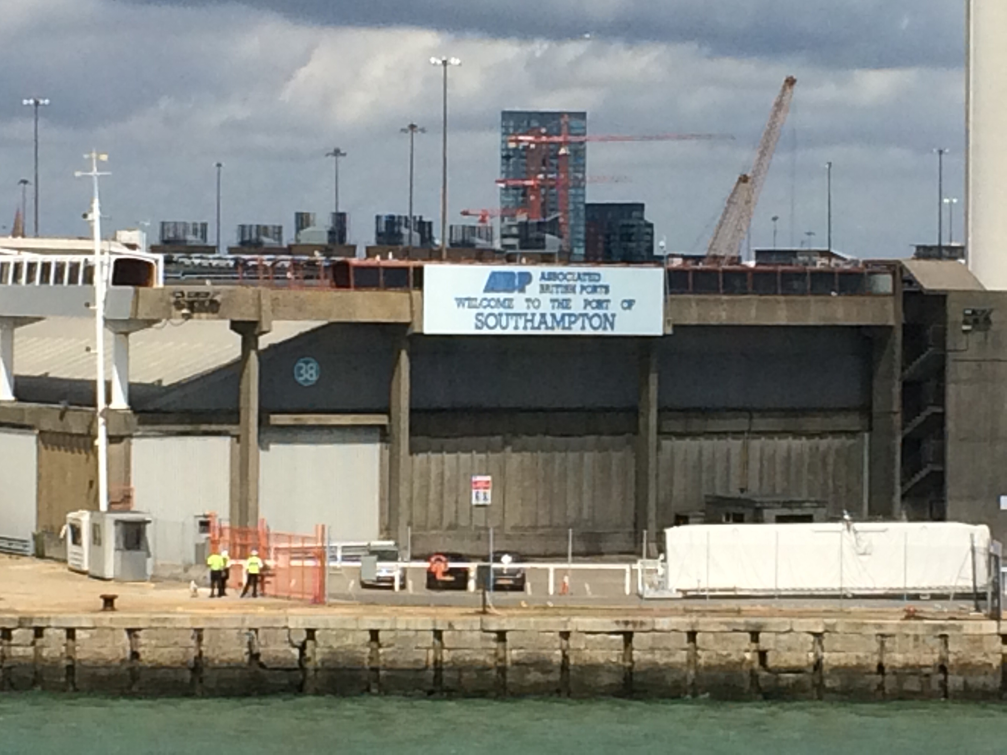
on the ferry, aiming at the racing yachts…how many can we take out?Welcome to Southampton! (I think this sign might indicate that more people arrive by boat than car)We docked in Southampton and I walked along the edge of the old town and across the bridge over the River Itchen.
one of 4 docked cruiselinersGod’s House Tower (built 15th Century to protect Mediaeval Southampton from attack)I walked all along the Weston Shore, past Netley Abbey and the Royal Victoria Military Hospital, both of which were landmarks from the ferry.
the (derelict) Royal Victoria Military HospitalAside from the wind, it was a lovely walk along the shoreline to Hamble-le-Rice. There were lots of anglers out and plenty of people enjoying the parkland.
looking bacl along the Weston Shore towards SouthamptonThe sun had come out and I walked up the River Hamble to my campsite.
WW2 anti-aircraft gun on the beach at Hamble-le-RiceI was relieved to find the campsite was next to the Mercury Yacht Harbour, which had a bar and restaurant overlooking the marina and the river. Perfect.
the view from the restaurant overlooking the Mercury Yacht Marina on the River Hamble
The wind had died to nothing overnight and so my tent and the long grass were soaking in the morning. The situation was not helped by my pitch being totally in the shade on a very sunny day. Not too much of a problem because the wind had picked up again so I just took my tent down, stood in the sunshine, and “flew” it like a kite.
the view from St Helens across Bembridge HarbourThe campsite/farm had an onsite cafe that opened at 9am. By 8.50 there were 30 people outside. I was hungry so went in the back door that had been opened to let some cool air in. The lovely lady let me get my order in before the rush and so, when the doors opened at 9, I was already eating scrambled eggs and drinking a mug of tea. I left a big tip (even though the fare wasn’t that good so I’ve no idea why there was such a queue).
St Helen’s Beach, looking at Bembridge PointI set off feeling happy with the world.
No Man’s Land Fort (one of 3 visible in the Solent)Before Nettlestone and after Ryde the path veered inland. It seemed to be taking me on a tour of the posh homes. Seaview in particular seemed to be where the sailing fraternity live. There were some lovely houses facing the Solent around Nettlestone Point, and lots of people milling about near dinghies. On such a beautiful, sunny day I wished I was joining them on the water (or in it).
Seaview Beach, looking at Nettlestone PointIt was so hot that I stopped at The Boat Inn, at Puckpool Point, for a break in the shade. They had newspapers so I lounged around for a bit pretending that my Saturday was just like everyone else’s.
Seaview Beach (boats in the Solent and Portsmouth in the distance)It wasn’t far to Ryde, just along the seafront through Appley Park. I stopped to admire the lovely Appley Tower; a coastal folly built in 1875 and used as a summerhouse. Appley TowerThere were lots of people strung out along the very thin beach and in the sea. Some people were really quite far out in the sea and yet still stood up, which was a good indication of just how shallow the water was at high tide. With such sheltered, shallow water it’s no wonder Ryde has been such a popular resort since Victorian times. It is also a SSSI and supports many migrating birds, eating on the mudflats at low tide.
Ryde East Sands, Portsmouth across the SolentI watched the hovercraft ferry coming and going; there was no way a boat would make it anywhere near the shore. There is a very long pier to service the regular ferry.
the Ryde hovercraft ferryIt was not a day for walking far so I stopped again, this time for a spot of lunch in a nice Italian restaurant near Ryde seafront. I wasn’t getting very far very fast, but it was too hot and I had decided to catch a bus the last few miles to avoid walking on the road.
I walked through Ryde suburbs (more nice houses) before hitting the parkland around Quarr Abbey. By now it was early afternoon and there were scores of yachts in the Solent, taking part in Cowes Week.
a great view of Cowes Week racing from Ryde suburbsI walked past the ruins of the Mediaeval Quarr Abbey. I thought rather ironic that a building of peace should have 2 gun loops for self defence against pirates. I wonder if the monks carried out regular firing practices? the ruins of the mediaeval Quarr Abbey facing the SolentI reached the current Quarr Abbey and stopped to admire it. It was a very large building to be built using small bricks and was architecturally very striking. It was designed by Dom Paul Bellot and built with Belgian bricks.
Quarr Abbey, made of bricksI walked through Fishbourne, up Kite Hill and across the bridge over Wooton Creek. Here I stopped and waited for the bus. The coast path to East Cowes followed a road and I thought I’d rather see it from the top deck of a bus.
I couldn’t get a glimpse of Osborne House as we went past it and down the hill into East Cowes. Although it was Cowes Week the campsite was happy to let me stay and I pitched in a nice sheltered patch. There was a bar on site and high speed wifi so I stayed put to eat and catch up with my blog. There was a singer crooning old favourites in the bar and I had a lovely view of the Solent. All was well. I had debated heading across the River Medina to Cowes to see what was going on for Cowes Week but was advised it would just be full of drunken partygoers. I could hear the music loud enough until well after midnight anyway. It sounded like a good party!
sunset over the Fawley Oil Refinery, from East Cowes
After a relatively chilly night everything was soaked in the morning so I took my time waiting for the sun to dry my tent. I caught the 9.30 bus back to Ventnor and went for a nice breakfast.
a map of the IOW (upside down) in a paddling pool in VentnorVentnor seafrontI love it when I find a good cafe; La Cantina in Ventnor was very good. It was almost 11am by the time I set off, walking along the Wheeler’s Bay to Bonchurch Seawall. It took 6000 cubic metres of concrete to make this ugly thing in 1988. I think I’d prefer a path on the high, chalky cliffs above.
walking the Wheeler’s Bay to Bonchurch SeawallIn the 19th Century Bonchurch was a fashionable centre for writers and artists, now it seems rather quieter. I passed through, noting the pretty St Boniface Church tucked into the trees.
St Boniface Church The day was heating up and I suddenly found myself walking through the trees, across The Landslip. There was no wind in here to cool me down. I might have been walking from Seaton to Lyme Regis as it was very similar terrain.
a “wishing seat” in The LandslipThe end of The Landslip coincided with the end of The Undercliff at Luccombe Bay. I couldn’t see the Bay without descending but I did see lots of large and well-hidden houses.
the view to Shanklin and SandownI popped out at Shanklin, the site where the Pluto oil pipeline left British shores and pumped oil across to France in 1944. There was more promenade and beach huts than there was beach but lots of people seemed to be enjoying the sunshine.
Shanklin promenadeI carried on to Sandown, which seemed quite rundown in places; there were a few buildings boarded up and even the zoo looked very tired.
Sandown beachOut of Sandown, ahead of me were Red Cliff and Whitecliff. Appropriate names for these sandstone and chalk cliffs.
Red Cliff and WhitecliffThe headland itself was called Culver Cliff and from the top there were commanding views back to Ventnor, and across Foreland and Bembridge Harbour to the Solent and Hampshire. I could easily make out Portsmouth.
Sandown Bay around to Dunnosethe view over Bembridge Harbour, Portsmouth in the distancelooking down on ForelandWhitecliff Bay was where the French landed in 1545 in an attempt to invade Britain before King Henry VIII had built his fort on Bembridge Down.
Whitecliff Bay and Culver CliffThe path took in some of the shoreline around Foreland as well as some of the more affluent streets in Bembridge. Here the water looked a rich caramel colour. Eventually I found Bembridge Harbour.
the ‘caramel’ sea along ForelandBembridge beachBembridge Harbour is well protected by a huge sandbar called The Duver.
Bembridge Harbour entranceAround the harbour were lots of houseboats, some of which were quite big and all were permanent homes.
one of many houseboats moored in Bembridge HarbourI stopped at a small campsite in St Helens, across the harbour from Bembridge. It had been another long, hot day.
I left the Youth Hostel just after 8am as yesterday I’d spied a cafe in Freshwater Bay that opened at 8.30. The Piano Cafe was lovely and one customer even tickled the ivories while I was there (it was Mozart or something that he played and we all applauded at the end).
Freshwater BaySuitably refreshed and fuelled I set off from Freshwater Bay in the sunshine. There was a gale force South-Westerly wind. At times during the day huge gusts would catch my rucksack and attempt to spin me round. It felt like a fight most of the way but I won so I was happy.
a closer view of the building hidden in the cliffLooking back towards The Needles it was striking how the cliffs changed halfway around Compton Bay. Echoing the Jurassic Coast (which the Isle of Wight would have butted up against when it was joined to the mainland) the cliffs changed from white chalk to a red sandstone and then clay. This resulted in the water changing from an opaque, milky colour, to a rusty red and then a muddy brown. Amazing.
the contrast between the chalk and the sandstone cliffs (Compton Bay)There was plenty of surf and surfers were out in Compton Bay. I passed a few campsites on the cliff and many of the tents looked like their poles were going to break. I walked through one campsite and couldn’t believe it when I read a sign outside one small tent with a big shelter and a brick-built stove. The sign advertised yoga lessons and was signed by Seaside Steve! Judging by his gear he must have been home and driven to this campsite. I was sorry he wasn’t in.
surfers in the sea at Compton BayAll along the South coast the path and the road (known as The Military Road) hug the edge of the crumbling cliffs. I can’t see either lasting forever. There is also plenty of evidence of landslides to complement the erosion. Today I could feel the force of nature for myself. These clay cliffs are supposed to be the best place to hunt for dinosaur fossils and I did see a couple of people looking.
a caravan park and muddy-coloured water at Grange ChineI negotiated my way around 6 chines (gouges in the cliff with streams flowing out), the most impressive being Whale Chine.
Whale ChineOn the clifftop near Shepherd’s Chine someone had jury rigged a zip line to send diving gear down to the beach below.
this zip wire is strictly not for people!Just before St Catherine’s Point the path climbed uphill, through Chale and around the Blackgang Chine Theme Park. I could hear the screams of people riding a rollercoaster.
the view from Blackgang ChineI could see St Catherine’s Oratory on the top of the hill. I didn’t climb up to see it and probably should have done to see this pepperpot beacon that served as the island’s first (Mediaeval) lighthouse. It was built in 1328 by Walter de Godeton on the orders of the Papal Court because he (and others) drank the shipment of wine they recovered from a nearby shipwreck. What a brilliant punishment.
St Catherine’s Oratory (and a mast) atop St Catherine’s HillI turned the corner around the Island’s most southerly point and almost immediately got some relief from the wind.
St Catherine’s Point lighthouseThe next section followed the ‘Undercliff of the Isle of Wight’; a continuous, narrow strip of landslipped terrain that runs 8 miles from Blackgang to Luccombe Bay. I could have been in East Devon (except this was bigger). The same types of rocks were involved in this landslip too: Upper Greensand and chalk, as well as Gault Clay.
looking down on St Lawrence, on The UndercliffAs it is south-facing, The Undercliff has one of the mildest, sunniest and most equable climates in Britain. This explains the profusion of palm trees in St Lawrence and the Ventnor Botanic Gardens.
descending to The Undercliff looking back up the cliffThe path started on the top of the high, inland cliffs and then dropped down onto The Undercliff at St Lawrence. This is a pretty little town with large Victorian houses studded into the cliff.
the view back along the inland clifflooking ahead to Steephill Cove and VentnorI descended the steps to Steephill Cove; somewhere I’ve been before. It was quite busy but nevertheless I stopped for an icecream just for old times sake. I was tired. Fortunately it wasn’t much further to Ventnor and here I ended my walk as I could catch a bus. I hadn’t wanted to camp on the South coast as it was too windy and there were no campsites the length of The Undercliff so I headed a couple of miles inland to Wroxall.
Steephill Cove (I’ve stayed in that fake lighthouse)I liked this campsite; it had a cafe and a laundry. I was able to dry my handwashed clothes while eating a cheap chilli and drinking a mug of tea. Thank goodness I didn’t have to walk to a pub.
a beautiful view back along the South Coast of the IOW
Lymington, Hampshire to Freshwater Bay, Isle of Wight
12 miles (+ ferry)
Totland YHA
I caught the train from Reading back to Lymington Town and then crossed the Lymington River, arriving at the ferry terminal before midday. This walk has definitely had a big impact on my need to plan and book. despite 6 days off I had not booked a thing and, best of all, was not stressed about it. That’s 18 years of conditioning I’ve undone in the last year!
back at LymingtonI was able to board the next ferry and by 1pm I was crossing the River Yar and walking out of Yarmouth.
the ferry at YarmouthI entered Fort Victoria Country Park and followed the track with the carved animals towards Fort Albert. These forts are opposite Hurst Castle and, together, all 3 protect the entrance to The Solent.
looking across the Solent to Hurst Castle and lighthouseAt Colwell Bay I stopped in the shade to eat my sandwiches and cake (thanks mum).
Colwell BayThe coast path connecting Colwell and Totland Bays only reopened last year after work to circumvent a landslide that happened in 2012.
oops, there’s been a landslidewhat’s left of Totland PierFrom Totland I headed over Headon Warren, the South side covered in beautiful purple heather.
purple heather on Headon Warren, looking across Alum Bay to The NeedlesI could see The Needles and Alum Bay with its chairlift down the cliff. This is where mum’s testube full of layers of different-coloured sand came from. I walked straight past as I’ve been on it before and I didn’t want to negotiate the pleasure park.
the Alum Bay chairliftthe lovely colours of Alum Bay cliffI climbed the cliff heading out to The Needles’ Batteries. There were some great views out towards Old Harry. The chalk cliffs were beautiful and white. The Needles looked thin and worn away!
The NeedlesBetween 1956 and 1971 there was a rocket engine test site here. Black Knight and Black Arrow rockets were held down in gantries and their engines fired up. If they passed they were sent Down Under for test launching.
the rocket engine test siteI turned East and headed up Tennyson Down to Tennyson’s Monument. Erected in 1897 it dominates the skyline. From the top of the Down I could just about see all the way to St Catherine’s Point and the flashing lighthouse.
Tennyson’s Monument atop Tennyson DownTennyson’s MonumentI dropped down into Freshwater Bay and then headed back to Totland, this time along the roads.
looking down on Freshwater BayThe Western tip of the Isle of Wight is an island in its own right as the River Yar runs all the way from Yarmouth to Freshwater Bay, bisecting the land.
the view along the Solent from Headon WarrenCompton Bay from Tennyson DownI got lucky and there was a spare bed in the Youth Hostel. I didn’t want to camp in the gale force wind that was blowing. I was able to get a cheap evening meal and access to rubbish wifi.
It was nice to be home. The garden had grown a bit! I enjoyed a few days doing very little except washing and mending my kit. Everything (including me) was getting a bit tired. For example: the rubber was wearing off my walking poles, my t-shirt had developed an irreparable hole and I had to order a new one, my shorts needed sewing up yet again, and my sandals had to be washed and soaked 3 times to rid them of their foul smell.
I also took the opportunity to visit my mum as I hadn’t seen her for over 6 months and I don’t want to be written out of her will. Plus, she’s good at sewing. Love you mum.