It was very windy during the night and I was glad that I was tucked behind a big hedge. It was a fairly dull start to the day but that didn’t last long and soon the sun was bright, the sky was blue and it was another scorcher. Unfortunately the wind died down so that made it feel hotter.
looking across The Fleet to Chesil BankIt was lovely walking through the Fleet Lagoon Nature Reserve, with great views of Chesil Bank. I was struck by the large numbers of butterflies, of several species; more than I had noticed elsewhere.
Chesil BankChesil Beach is one of the finest storm beaches in the world; formed over 6000 years ago by rising sea levels. It is 18 miles long, rises up to 15m high in places, and is made up of 100 million tonnes of pebbles. It is amazing to walk alongside (it would be energy-sapping to walk along it) and to see how it changes. The pebbles grow in size from pea-sized in the West to potato-sized in the East. Apparently, on a foggy day, local fishermen (and smugglers) can tell whereabouts they are on Chesil Beach just by the size of the stones.
Chesil Bank is quite big in placesI walked past a couple of Army camps on the edge of Weymouth and found out later that the town had been the main base for Anzac troops convalescing during WW1.
another view of The Fleet and Chesil BankAfter an exposed walk in the heat, with no refreshment stops, I made it to Wyke Regis and Ferrybridge, the tip of Weymouth. I was hungry.
Chesil Beach curving around to the Isle of PortlandI crossed the road heading across the tombolo to the Isle of Portland, that would be tomorrow’s walk. Instead I turned North East and walked along the edge of Portland Harbour towards Weymouth sea front.
a plaque on the housing estate is the only reminder this was once the site of a torpedo factoryRight at the tip was a housing estate built on the site of the demolished Whitehead’s Torpedo Factory. Torpedoes were built here, and tested in the harbour, between 1891 and 1969.
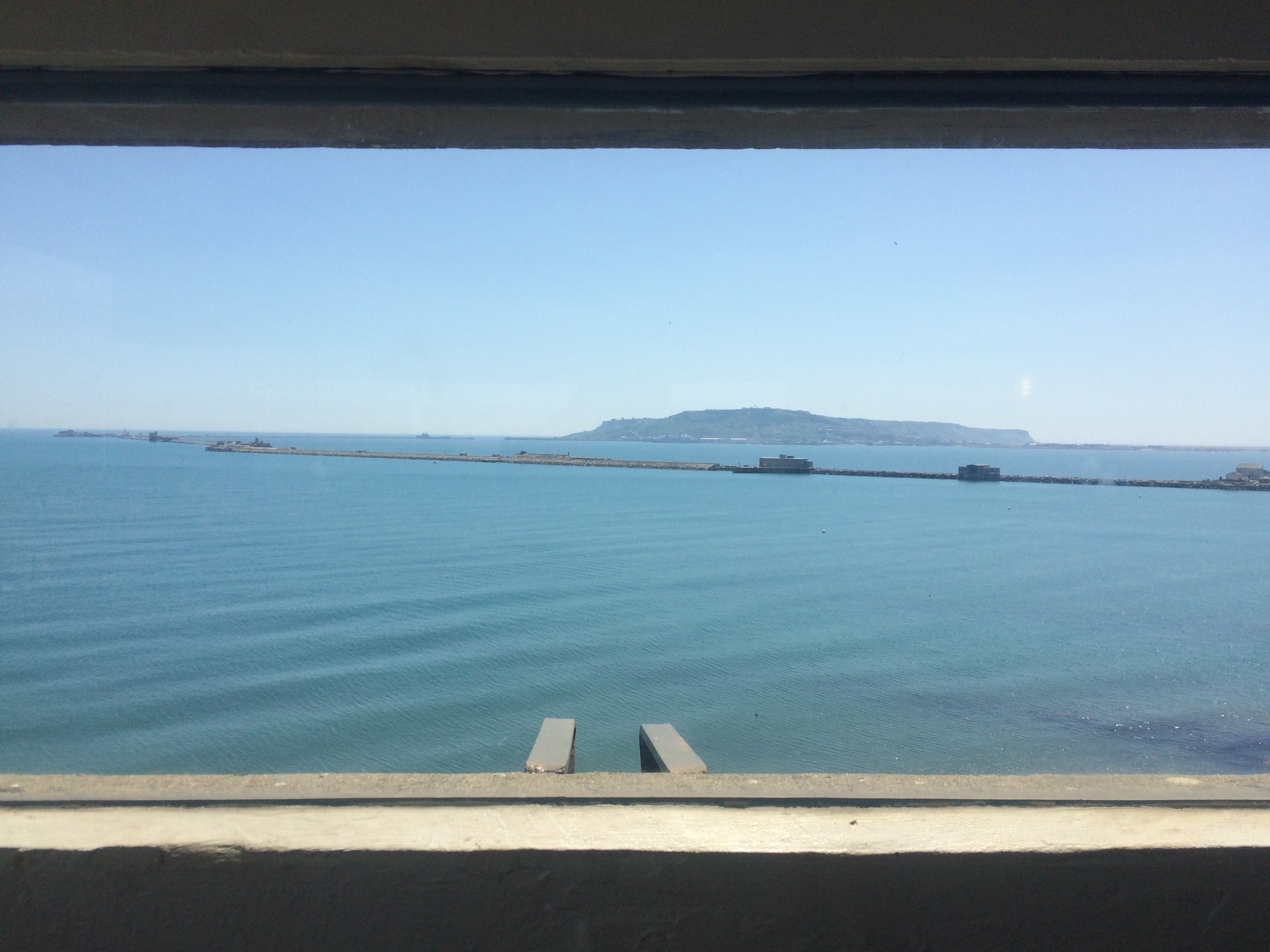
looking down one of the breakwaters that creates Portland HarbourPortland Harbour was a Victorian engineering project that took 23 years to complete by 1872. Back then it was one of the largest man-made harbours in the world and Europe’s finest deep-water port. Naturally it needed protecting and so 3 forts were built: one in Weymouth (Nothe Fort), one on Portland, and one on the Breakwater. These forts were part of the 74 Lord Palmerston forts built all along the South coast, from Milford Haven to Harwich, to protect us against the threat of a French invasion. (Every day more jigsaw pieces are added to the picture in my head.)
the view from Nothe Fort, protecting Portland HarbourI thought the harbour looked impressive. I stopped for an ice cream at Sandsfoot Castle, built under the orders of King Henry VIII to protect shipping in the ‘Portland Roads’. Thus confirming that Portland Harbour has been important for a long time.
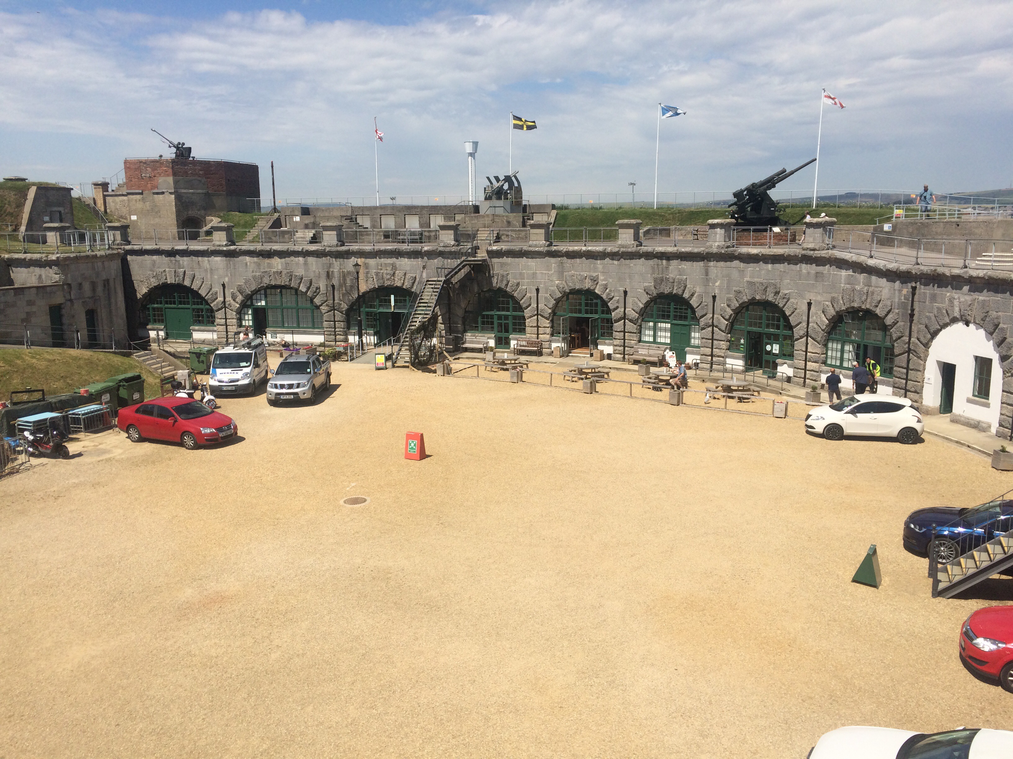
Sandsfoot Castle ruinsI was still hungry. I saw a sign for a cafe at Nothe Castle (rhymes with clothe) and made a beeline. After some refreshment I took the opportunity to look around the fort and I’m glad I did. It had some excellent displays and was a great little museum. Being a fort, it was of course well placed to afford some of the best views. How lucky that the sky had turned so blue to make the views all the way from the Isle of Portland to the Isle of Purbeck even more spectacular. I stayed for a while to enjoy them.
inside Nothe Fortlooking at Weymouth from Nothe FortI like to catch a ferry and there was a rowing boat ferry across the River Wey from Nothe Fort Gardens to the old harbour. I hadn’t been ferried by a rowing boat since Suffolk! This one cost me £1.
my ferry across the River WeyThe summer holidays had started; Weymouth Beach was packed. There were people everywhere, many burning in the hot sun. The green sea looked cooling but I couldn’t face the crowds so I carried on walking along the promenade, dodging the tourists.
Weymouth BeachI was intrigued to see the Royal Navy holding a beach rugby tournament; a good way to draw in spectators.
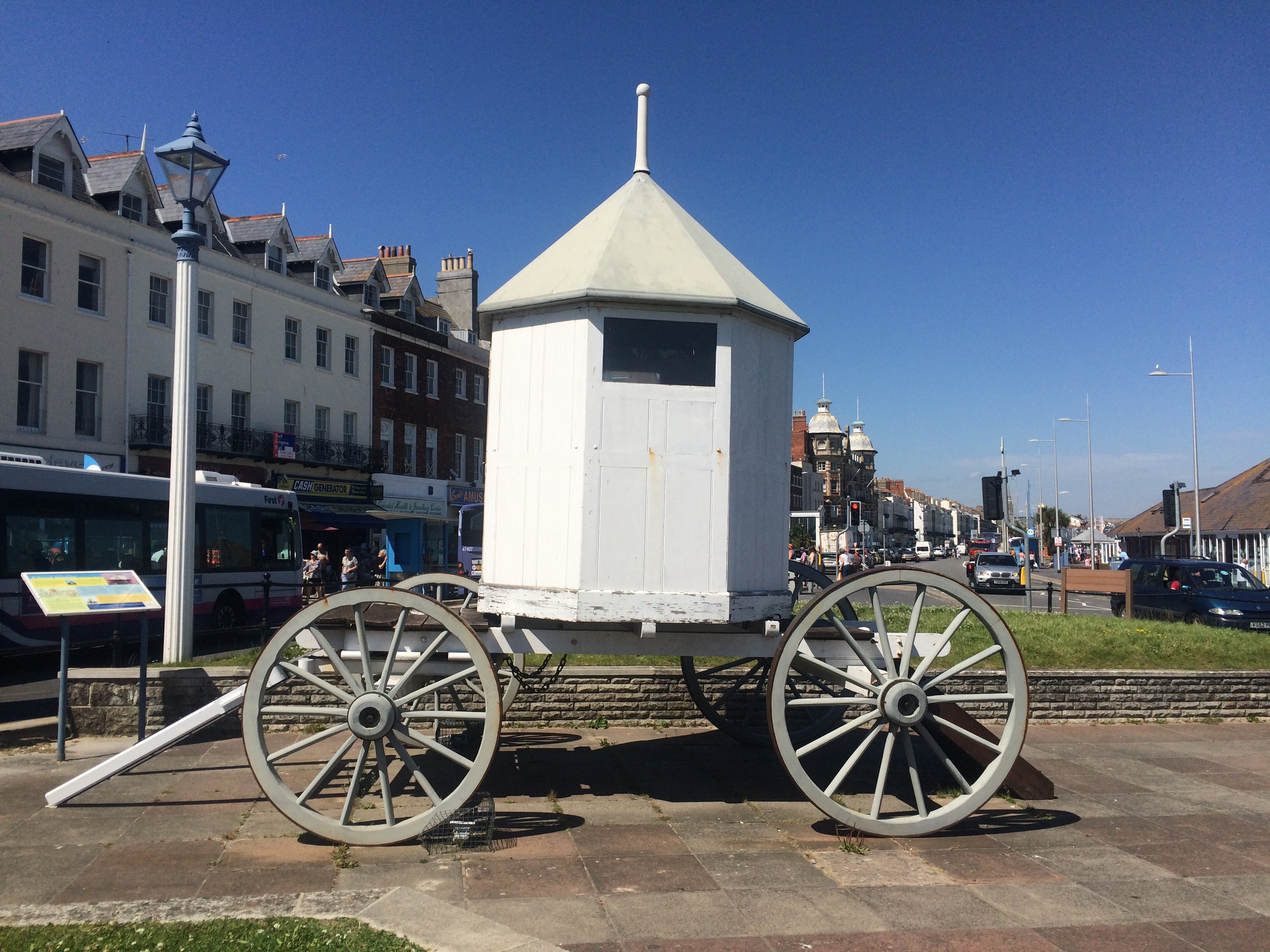
Weymouth is known for its sand sculptures – apparently it’s the right kind of sand!King George III spent 14 summers in Weymouth, helping to establish it as a holiday destination from the late 18th Century. The town’s affection for the King was evident. I admired his bathing machine sat in the middle of a roundabout.
a bathing hut fit for a KingI had arranged to meet up with my next-door-neighbour, Grace, as she often works in Weymouth. So, once I reached Lodmoor Country Park, I turned around and walked back along the promenade to the harbour and the Ship Inn.
the beautiful white cliffs of White Nothe (and all along to Lulworth) visible from Weymouth Beachlooking back along Weymouth Beach to Nothe Fort and PortlandAfter a lovely catch-up with Grace (and the chance to rid myself of a few old maps) I was collected by Geoff and driven to his house in Dorchester. It was great to see Geoff and Kath, enjoy a BBQ, do my laundry and sleep in a bed.
Weymouth Harbourtypical Weymouth seafront houses, all decked in bunting


A ferry boat in Suffolk must seem like 3000 miles ago……..oh wait a minute it was 3000 miles ago!!!!!! On on Juice not far now till Tower Bridge.
LikeLike